
1943 Silver Lake Aeronautical Chart – WWII U.S. Army Air Forces Restricted Map
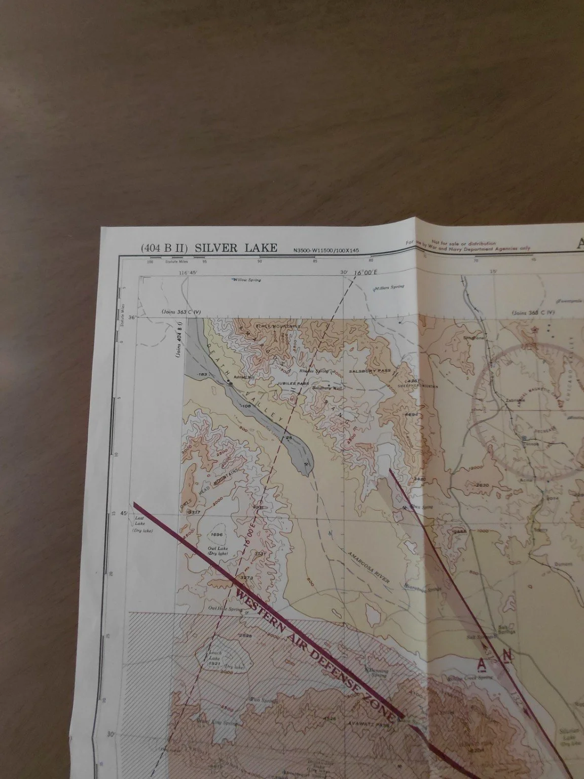
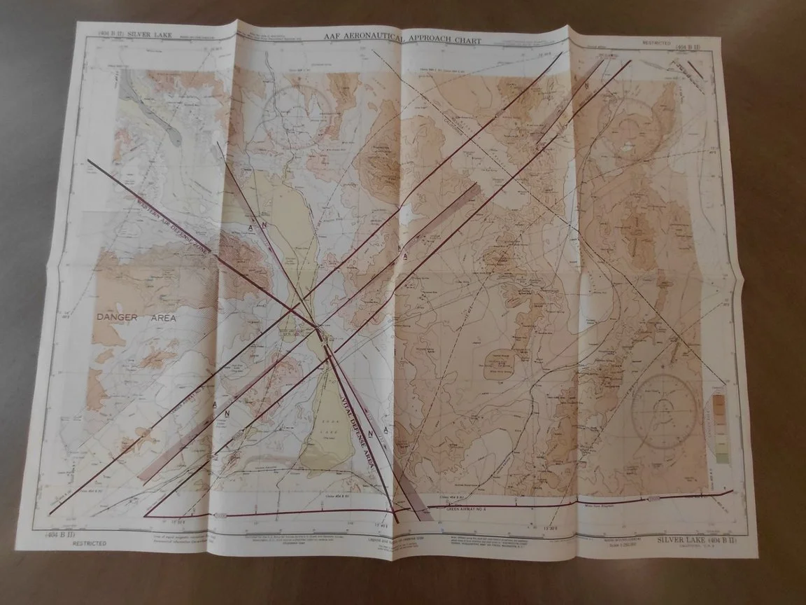
This is an original Army Air Forces Aeronautical Chart (Silver Lake 404 B II), issued December 1943 during World War II. Produced by U.S. War and Navy Department Agencies, this map was RESTRICTED and never available for public sale. Unlike civilian sectional charts, these were tactical approach maps created exclusively for military aviation use during the war.
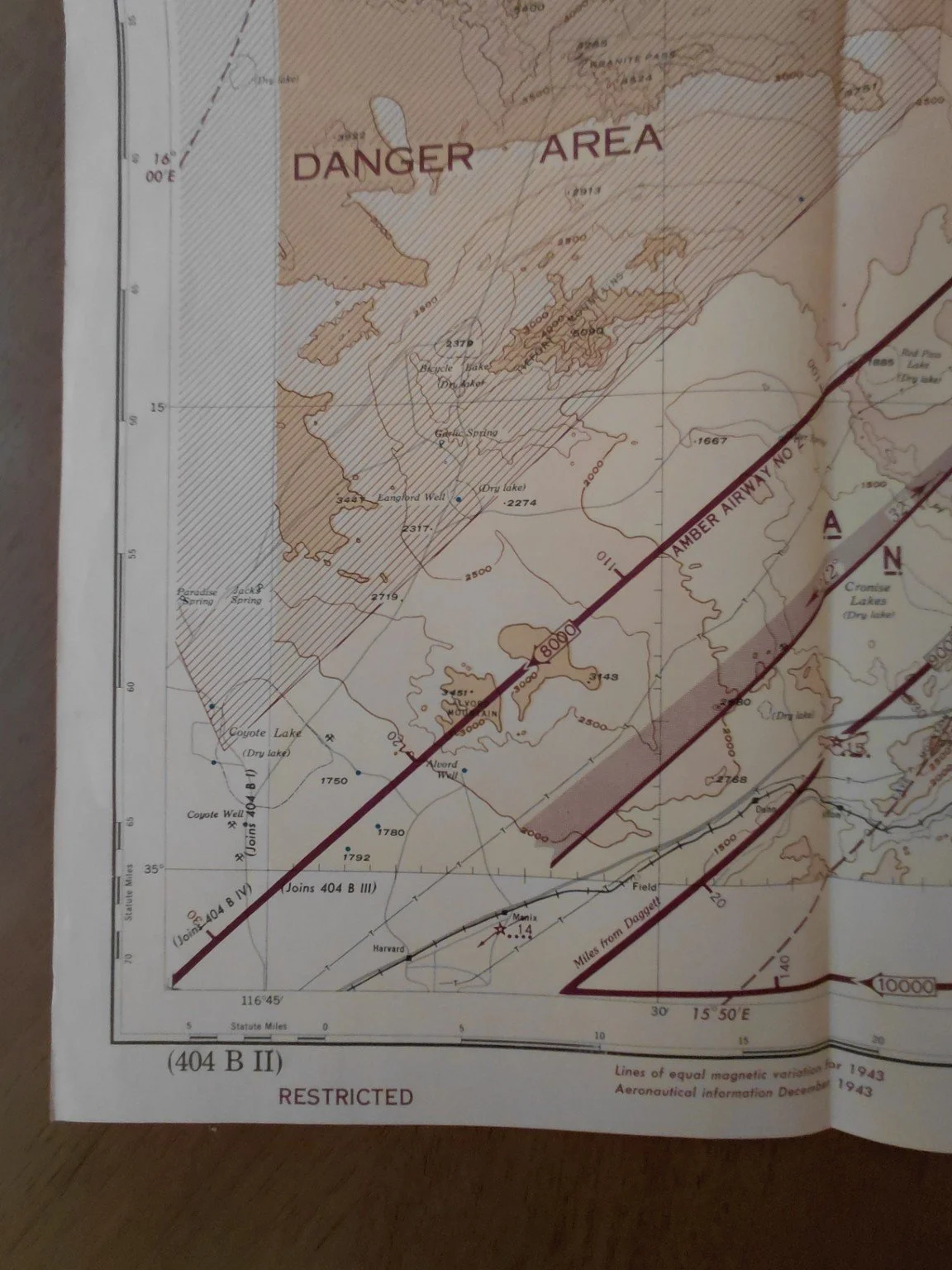
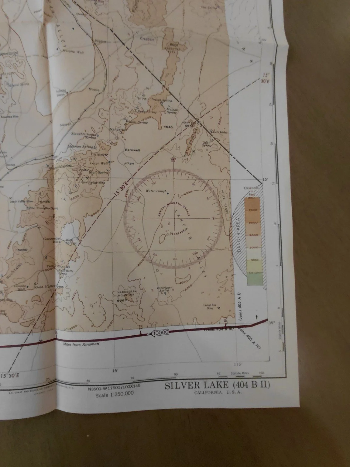
Covering the California–Nevada desert region, including Silver Lake, Coyote Lake, Pacific Jackass Canyon, and the Mojave Desert, the chart highlights:
Western Air Defense Zone (red-striped restricted zone)
Marked Danger Areas and military-only flight corridors
Detailed topography and elevation shading at 1:250,000 scale
Navigational features tailored for U.S. Army Air Forces pilots
Issued as part of a highly limited run for military use, these charts are far scarcer than standard civilian sectionals, reflecting the air defense measures implemented across the western United States during WWII.
Details
Date: December 1943
Issued by: U.S. War & Navy Department Agencies
Scale: 1:250,000
Designation: (404 B II) Silver Lake
Markings: RESTRICTED – Not for sale or distribution
Condition: Folded as issued, excellent printing clarity, very good overall condition with no major defects (minor fold wear only).
Historical Significance
Silver Lake and the Mojave Desert were key training and testing grounds for U.S. Army Air Forces during WWII. Charts like this guided bomber and fighter crews as they trained for missions across the Pacific and European theaters. Because these were restricted defense documents, survival rates were low, making them a prized collectible today.
This is an original Army Air Forces Aeronautical Chart (Silver Lake 404 B II), issued December 1943 during World War II. Produced by U.S. War and Navy Department Agencies, this map was RESTRICTED and never available for public sale. Unlike civilian sectional charts, these were tactical approach maps created exclusively for military aviation use during the war.
Covering the California–Nevada desert region, including Silver Lake, Coyote Lake, Pacific Jackass Canyon, and the Mojave Desert, the chart highlights:
Western Air Defense Zone (red-striped restricted zone)
Marked Danger Areas and military-only flight corridors
Detailed topography and elevation shading at 1:250,000 scale
Navigational features tailored for U.S. Army Air Forces pilots
Issued as part of a highly limited run for military use, these charts are far scarcer than standard civilian sectionals, reflecting the air defense measures implemented across the western United States during WWII.
Details
Date: December 1943
Issued by: U.S. War & Navy Department Agencies
Scale: 1:250,000
Designation: (404 B II) Silver Lake
Markings: RESTRICTED – Not for sale or distribution
Condition: Folded as issued, excellent printing clarity, very good overall condition with no major defects (minor fold wear only).
Historical Significance
Silver Lake and the Mojave Desert were key training and testing grounds for U.S. Army Air Forces during WWII. Charts like this guided bomber and fighter crews as they trained for missions across the Pacific and European theaters. Because these were restricted defense documents, survival rates were low, making them a prized collectible today.