
1944 Austin Sectional Aeronautical Chart – WWII Aviation Map (P-5 Restricted)
Description:
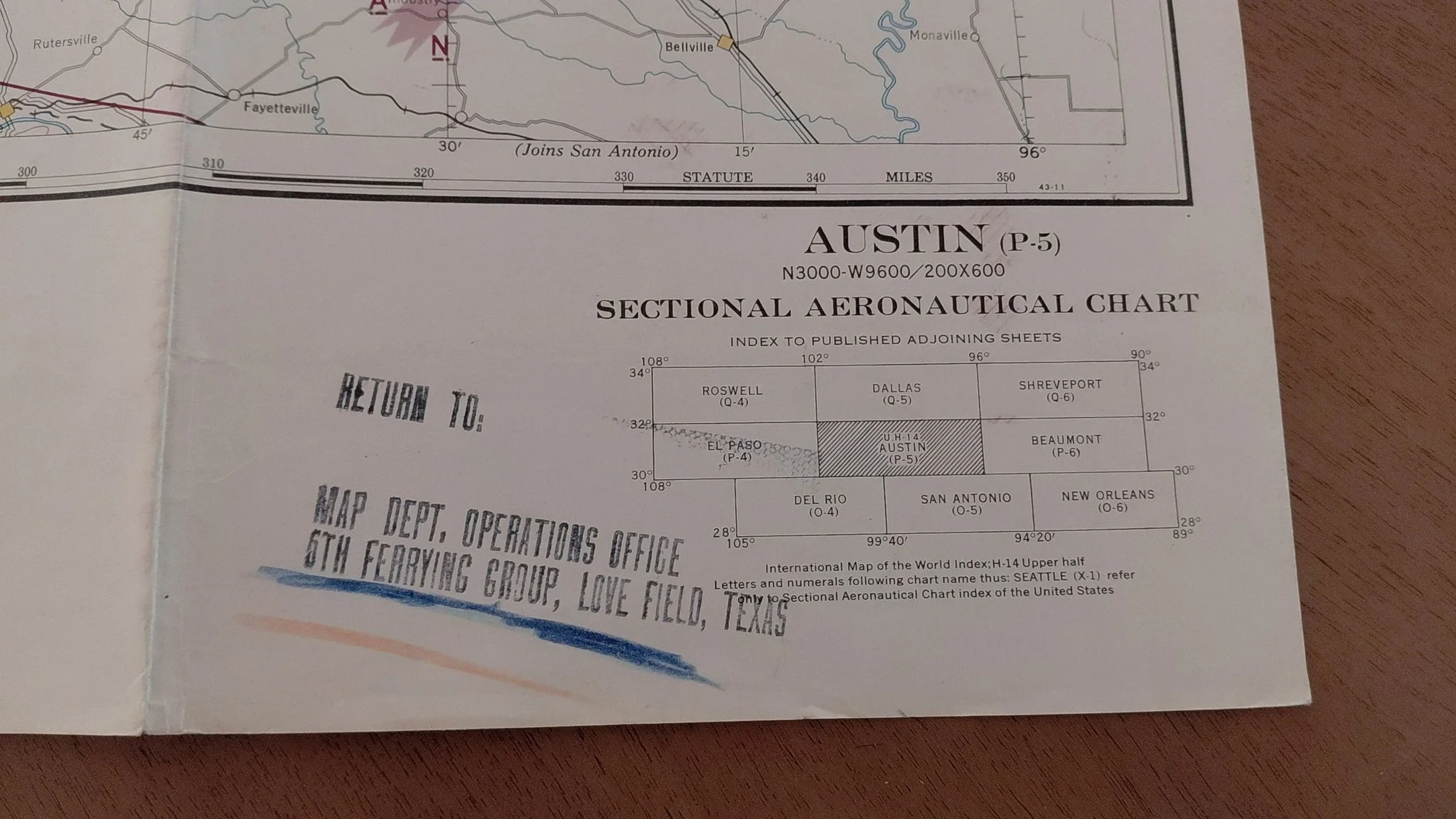
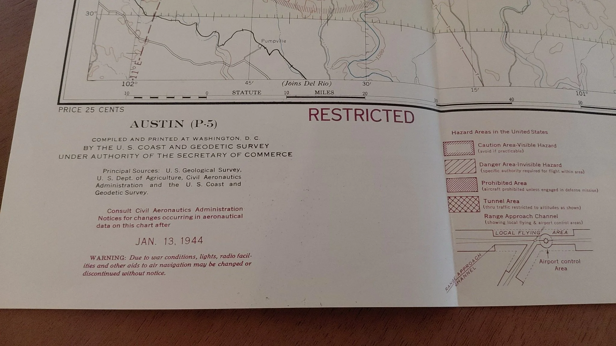
Original Austin (P-5) Sectional Aeronautical Chart, dated January 13, 1944, compiled and printed by the U.S. Coast and Geodetic Survey under the authority of the Secretary of Commerce. Issued at the height of World War II, this chart was marked “RESTRICTED” due to wartime security concerns and displays the critical navigation data used by aviators operating across central Texas.
This particular copy bears a return stamp to the Map Dept., Operations Office, 6th Ferrying Group, Love Field, Texas, directly tying it to U.S. Army Air Forces operations in WWII.
Features:
Date: January 13, 1944
Publisher: U.S. Coast & Geodetic Survey
Original price: 25 cents
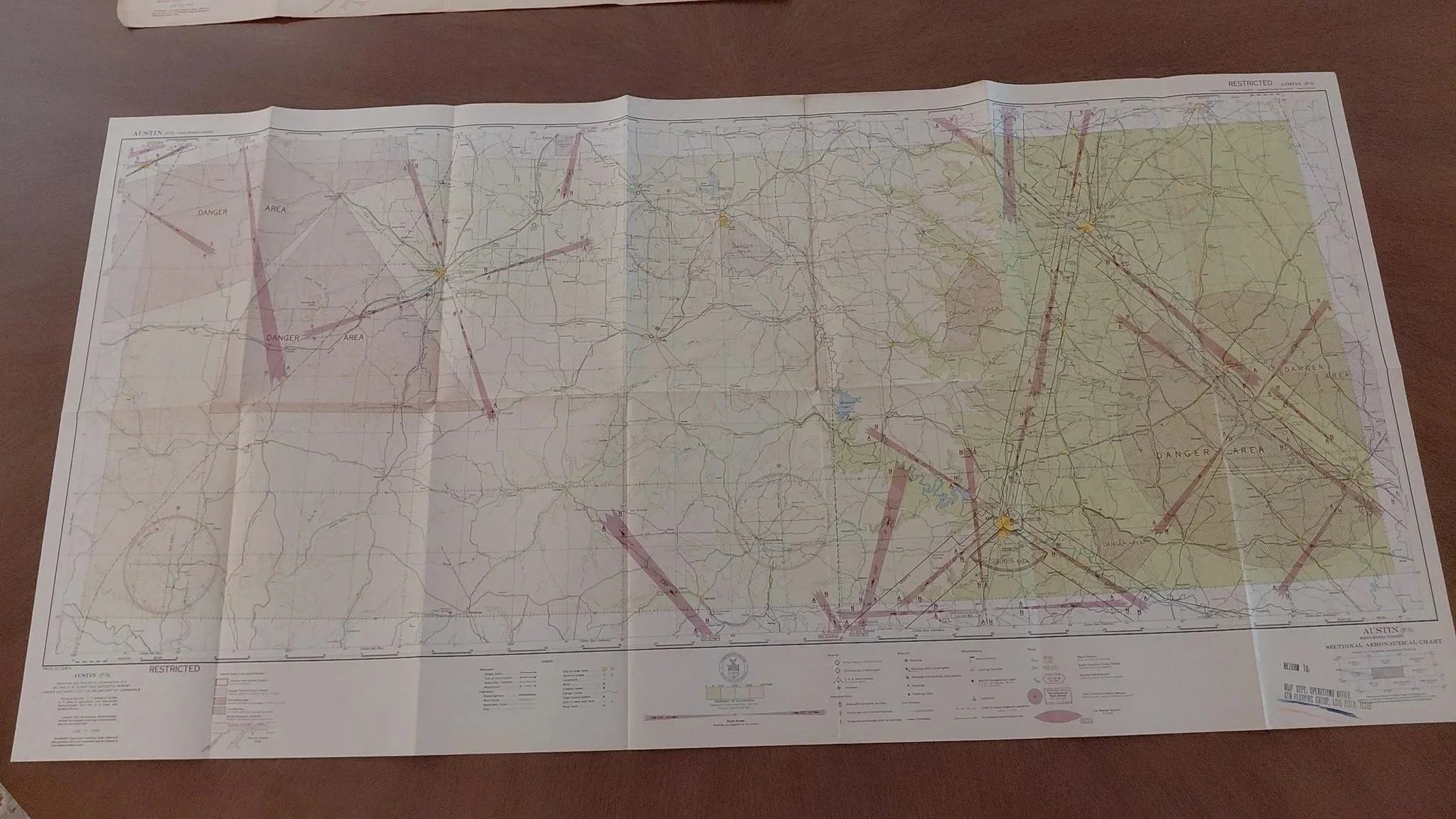
Marked RESTRICTED with WWII hazard zones (Danger Areas, Prohibited Areas, Range Approach Channels, etc.)
Clear historical stamp linking it to 6th Ferrying Group, Love Field
Folded, as originally issued to pilots
Excellent survival with strong colors and crisp printing
Condition:
This chart is basically unused and in amazing shape for its age. Only a light ink stain on the reverse side, otherwise exceptionally clean with no major flaws.
Dimensions:
Approx. 21 × 47 inches unfolded.
Historical Significance:
The 6th Ferrying Group was responsible for ferrying aircraft to and from manufacturing plants and bases during WWII. A surviving Austin-area chart tied to that unit is both historically important and highly collectible.
Description:
Original Austin (P-5) Sectional Aeronautical Chart, dated January 13, 1944, compiled and printed by the U.S. Coast and Geodetic Survey under the authority of the Secretary of Commerce. Issued at the height of World War II, this chart was marked “RESTRICTED” due to wartime security concerns and displays the critical navigation data used by aviators operating across central Texas.
This particular copy bears a return stamp to the Map Dept., Operations Office, 6th Ferrying Group, Love Field, Texas, directly tying it to U.S. Army Air Forces operations in WWII.
Features:
Date: January 13, 1944
Publisher: U.S. Coast & Geodetic Survey
Original price: 25 cents
Marked RESTRICTED with WWII hazard zones (Danger Areas, Prohibited Areas, Range Approach Channels, etc.)
Clear historical stamp linking it to 6th Ferrying Group, Love Field
Folded, as originally issued to pilots
Excellent survival with strong colors and crisp printing
Condition:
This chart is basically unused and in amazing shape for its age. Only a light ink stain on the reverse side, otherwise exceptionally clean with no major flaws.
Dimensions:
Approx. 21 × 47 inches unfolded.
Historical Significance:
The 6th Ferrying Group was responsible for ferrying aircraft to and from manufacturing plants and bases during WWII. A surviving Austin-area chart tied to that unit is both historically important and highly collectible.