

1944 Corpus Christi Sectional Aeronautical Chart (N-5 Restricted) – WWII Aviation Map
Description
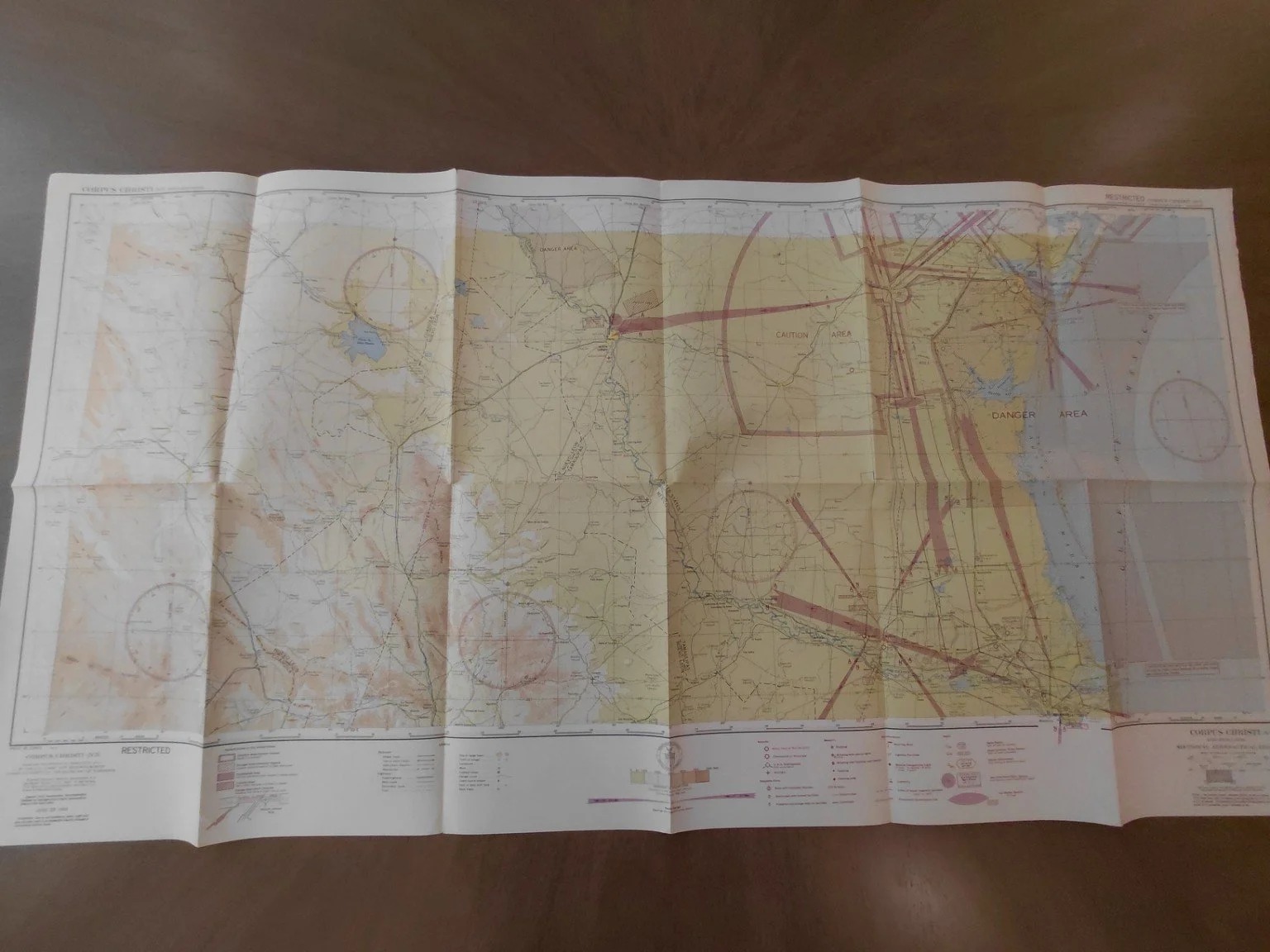
This is an original World War II U.S. sectional aeronautical chart (Corpus Christi N-5), dated June 29, 1944, and issued by the U.S. Coast and Geodetic Survey under the authority of the Secretary of Commerce. Printed with a face value of just 25 cents, this chart was marked “RESTRICTED” and intended for use by military and approved civilian aviators during wartime.
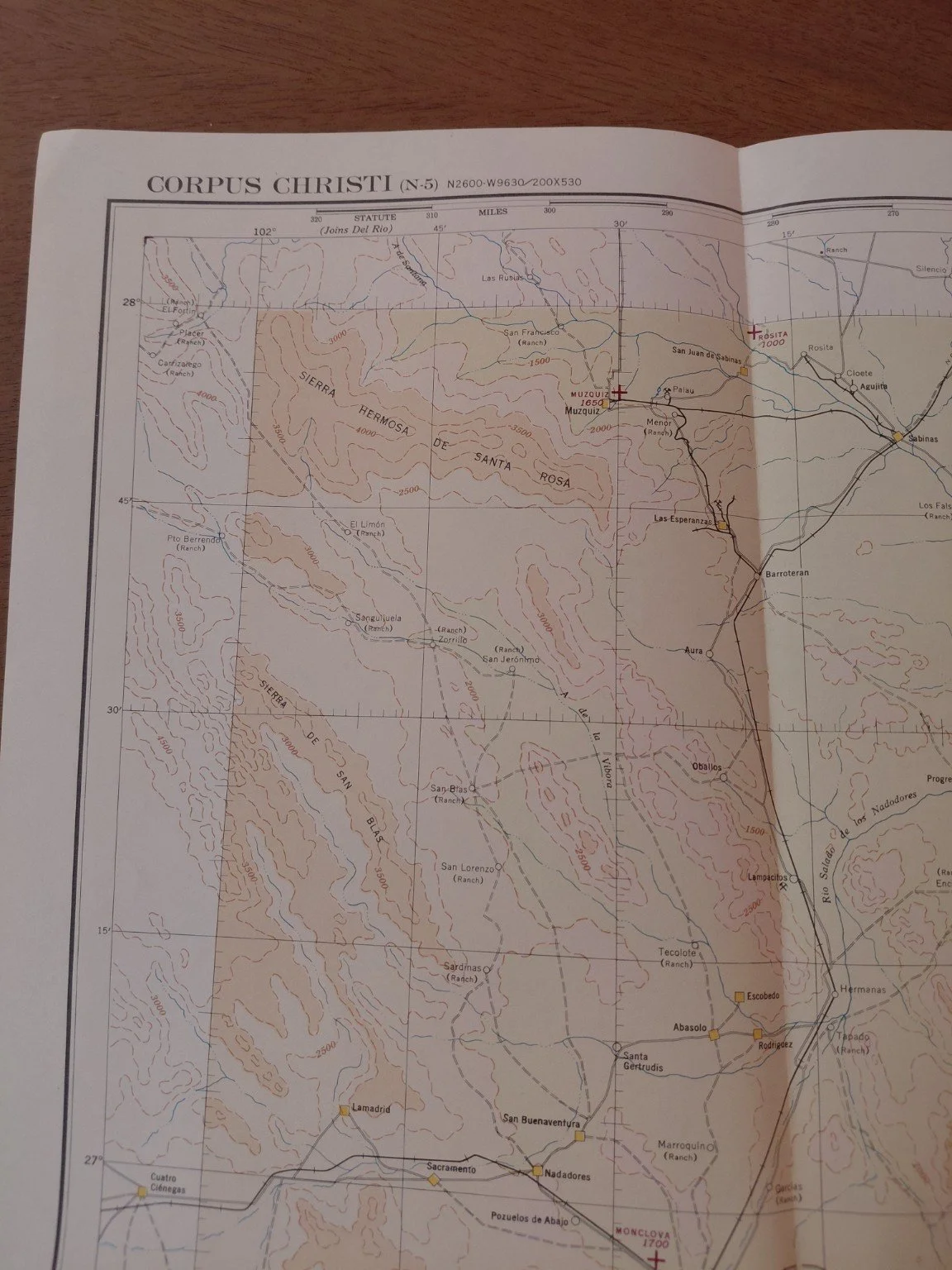
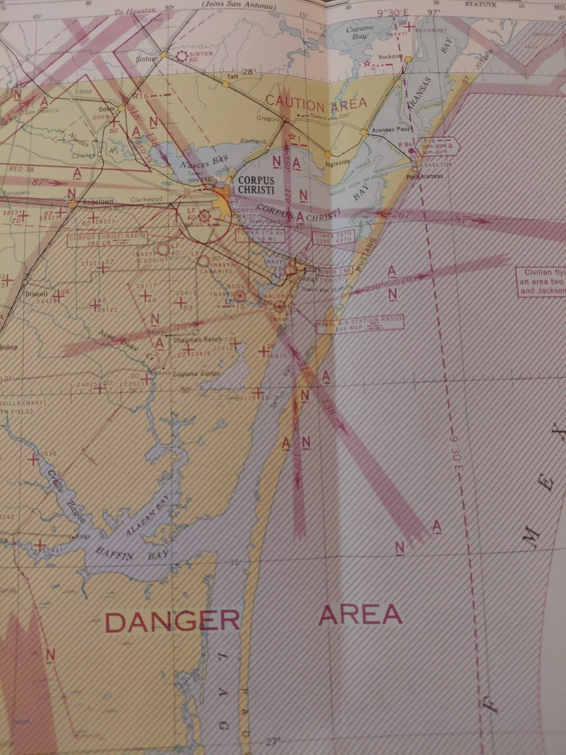
Covering the Texas Gulf Coast and adjoining portions of northern Mexico, this chart centers on Corpus Christi—a major U.S. Navy aviation hub during WWII. The map highlights Corpus Christi Naval Air Station, Cuddihy Field, and associated naval auxiliary fields that trained thousands of Navy pilots.
Notably, the chart bears explicit wartime restrictions:
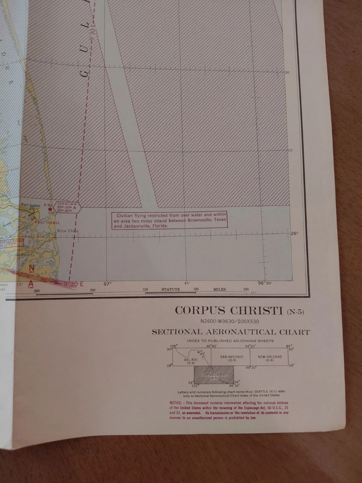
“Civilian flying restricted from over water and within an area two miles inland between Brownsville, Texas and Jacksonville, Florida.”
This was part of the Gulf Coast defense network against German U-boat activity and other threats, making the map both a practical navigation aid and a document of U.S. wartime security measures.
Features
Date: June 29, 1944
Chart Number: Corpus Christi (N-5)
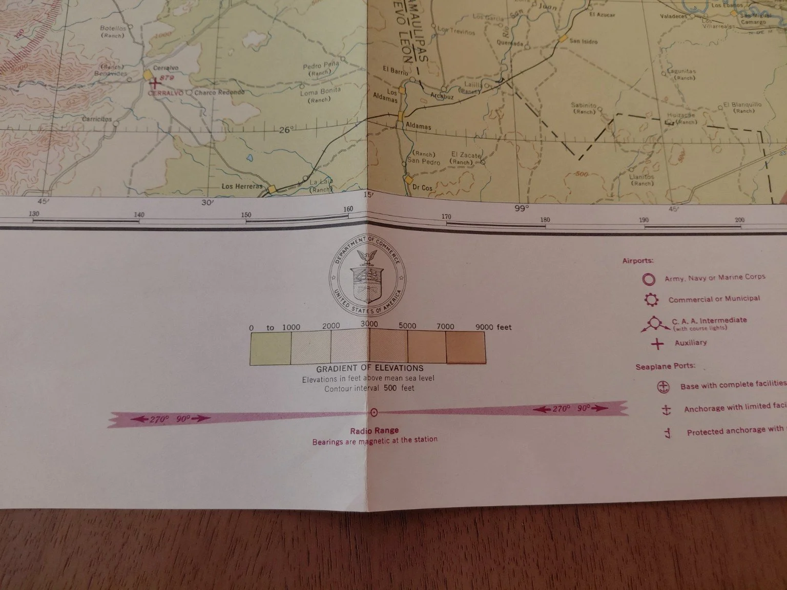
Scale: 1:500,000
Issued by: U.S. Coast and Geodetic Survey, Washington D.C.
Sources: U.S. Geological Survey, U.S. Dept. of Agriculture, Civil Aeronautics Administration, and the Mexican Government (for border regions)
Original Printed Price: 25¢
Markings: Clearly labeled Danger Areas, Caution Areas, and Restricted Civilian Flight Zones
Geographic Coverage:
Corpus Christi, Aransas Pass, Padre Island, Baffin Bay
Port Isabel & Brownsville, TX
Inland coverage extending toward San Antonio
Northern Mexico (Nuevo León and Tamaulipas)
Condition
Folded as originally issued
Bright, clean, and well-preserved with excellent color retention
No tears, burns, or major stains
Very minor handling wear only — a solid very good to excellent example
Description
This is an original World War II U.S. sectional aeronautical chart (Corpus Christi N-5), dated June 29, 1944, and issued by the U.S. Coast and Geodetic Survey under the authority of the Secretary of Commerce. Printed with a face value of just 25 cents, this chart was marked “RESTRICTED” and intended for use by military and approved civilian aviators during wartime.
Covering the Texas Gulf Coast and adjoining portions of northern Mexico, this chart centers on Corpus Christi—a major U.S. Navy aviation hub during WWII. The map highlights Corpus Christi Naval Air Station, Cuddihy Field, and associated naval auxiliary fields that trained thousands of Navy pilots.
Notably, the chart bears explicit wartime restrictions:
“Civilian flying restricted from over water and within an area two miles inland between Brownsville, Texas and Jacksonville, Florida.”
This was part of the Gulf Coast defense network against German U-boat activity and other threats, making the map both a practical navigation aid and a document of U.S. wartime security measures.
Features
Date: June 29, 1944
Chart Number: Corpus Christi (N-5)
Scale: 1:500,000
Issued by: U.S. Coast and Geodetic Survey, Washington D.C.
Sources: U.S. Geological Survey, U.S. Dept. of Agriculture, Civil Aeronautics Administration, and the Mexican Government (for border regions)
Original Printed Price: 25¢
Markings: Clearly labeled Danger Areas, Caution Areas, and Restricted Civilian Flight Zones
Geographic Coverage:
Corpus Christi, Aransas Pass, Padre Island, Baffin Bay
Port Isabel & Brownsville, TX
Inland coverage extending toward San Antonio
Northern Mexico (Nuevo León and Tamaulipas)
Condition
Folded as originally issued
Bright, clean, and well-preserved with excellent color retention
No tears, burns, or major stains
Very minor handling wear only — a solid very good to excellent example