
Description:
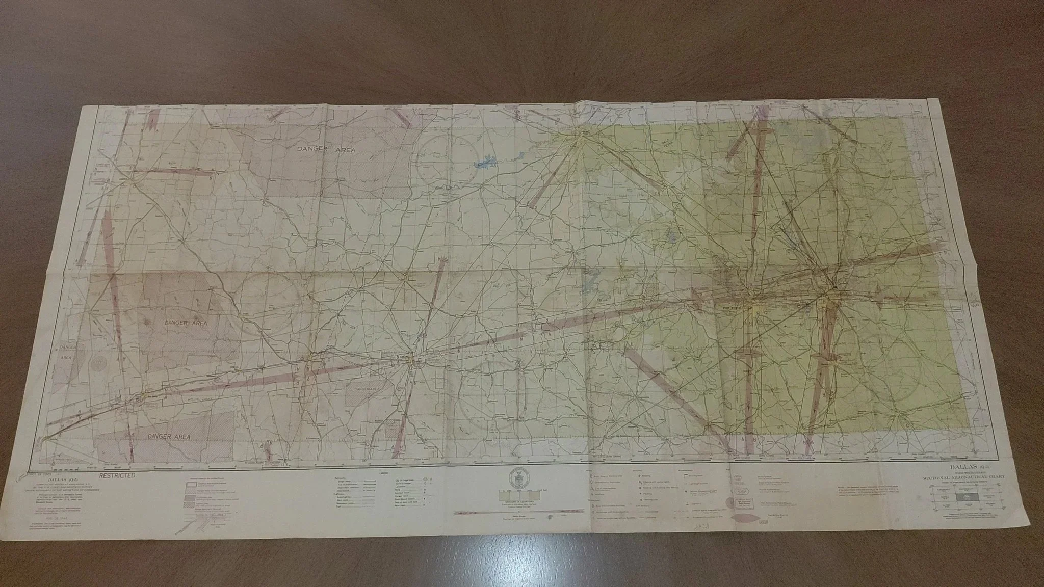
Original Dallas (Q-5) Sectional Aeronautical Chart, issued August 24, 1944, compiled and printed by the U.S. Coast and Geodetic Survey under the authority of the Secretary of Commerce. These charts were vital navigation tools for aviators during World War II, showing air routes, restricted zones, “Danger Areas,” railroads, highways, and terrain across Texas.
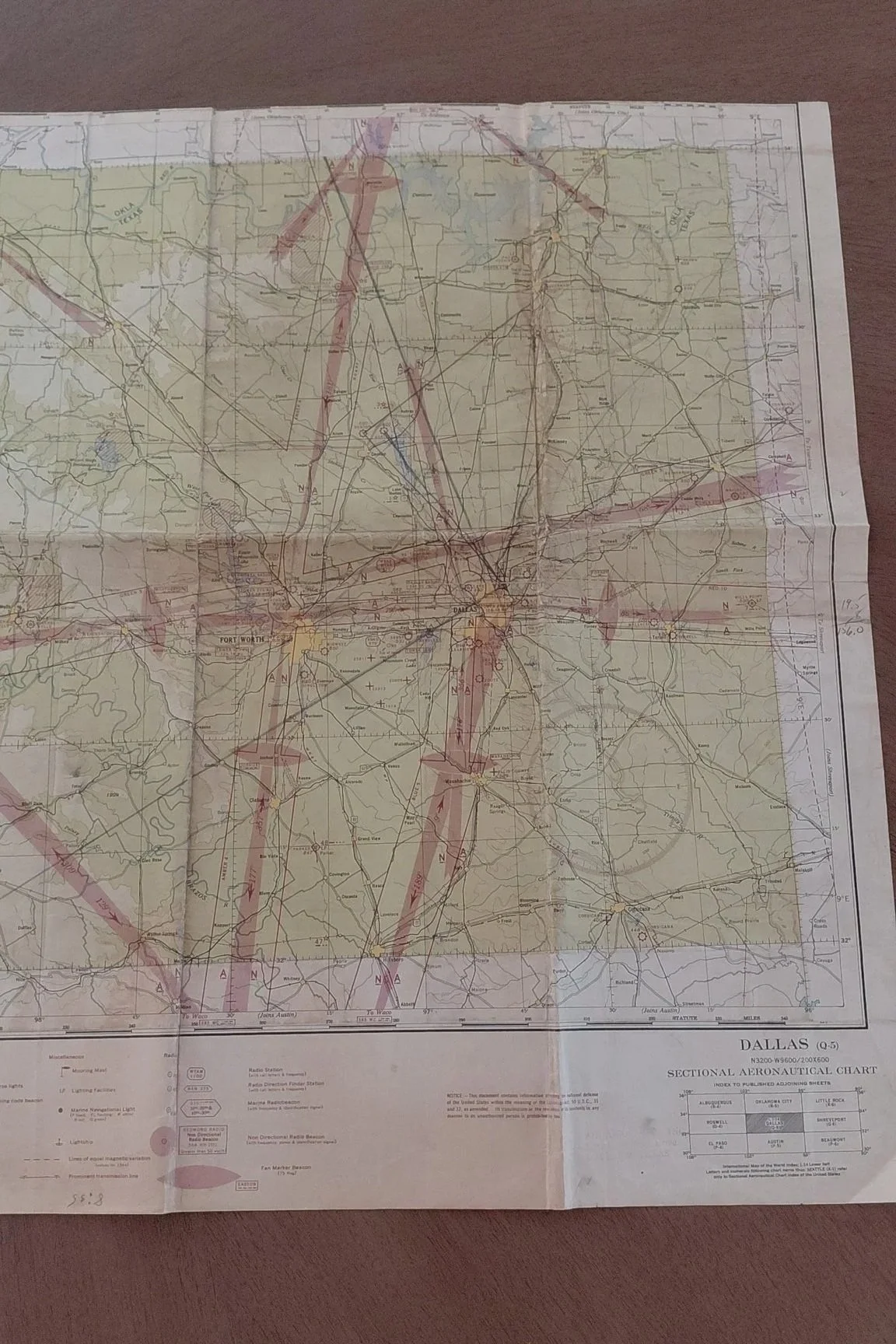
This example covers the Dallas–Fort Worth region westward toward Midland and Big Spring. Marked with “RESTRICTED” and hazard areas due to wartime activity, it reflects the military environment of late 1944.
Features:
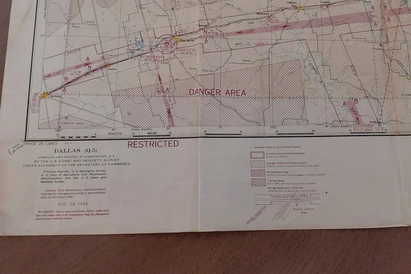
Date: August 24, 1944
Publisher: U.S. Coast & Geodetic Survey
Original price: 25 cents (printed on the map)
Includes WWII “Danger Areas” and “Restricted Zones”
Folded, as originally issued to aviators
Clear colors, crisp details, excellent preservation for age
Condition:
This map is in very good condition, with normal fold lines but no significant tears or stains. Remarkably well preserved for being over 80 years old.
Dimensions:
Approx. 21 x 42 inches unfolded.
Historical Significance:
Issued during the height of WWII aviation activity, this map would have been used by both civilian and military pilots navigating restricted Texas airspace. Surviving examples in good condition are scarce and highly collectible.
Description:
Original Dallas (Q-5) Sectional Aeronautical Chart, issued August 24, 1944, compiled and printed by the U.S. Coast and Geodetic Survey under the authority of the Secretary of Commerce. These charts were vital navigation tools for aviators during World War II, showing air routes, restricted zones, “Danger Areas,” railroads, highways, and terrain across Texas.
This example covers the Dallas–Fort Worth region westward toward Midland and Big Spring. Marked with “RESTRICTED” and hazard areas due to wartime activity, it reflects the military environment of late 1944.
Features:
Date: August 24, 1944
Publisher: U.S. Coast & Geodetic Survey
Original price: 25 cents (printed on the map)
Includes WWII “Danger Areas” and “Restricted Zones”
Folded, as originally issued to aviators
Clear colors, crisp details, excellent preservation for age
Condition:
This map is in very good condition, with normal fold lines but no significant tears or stains. Remarkably well preserved for being over 80 years old.
Dimensions:
Approx. 21 x 42 inches unfolded.
Historical Significance:
Issued during the height of WWII aviation activity, this map would have been used by both civilian and military pilots navigating restricted Texas airspace. Surviving examples in good condition are scarce and highly collectible.