
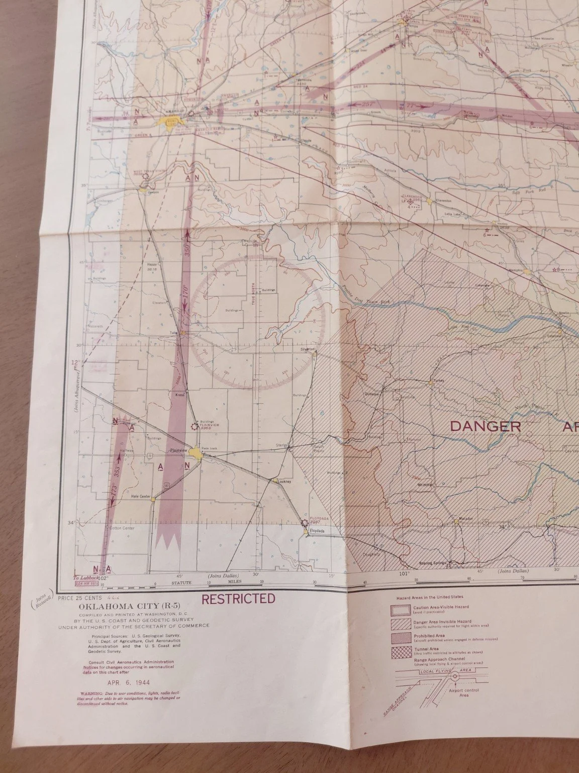
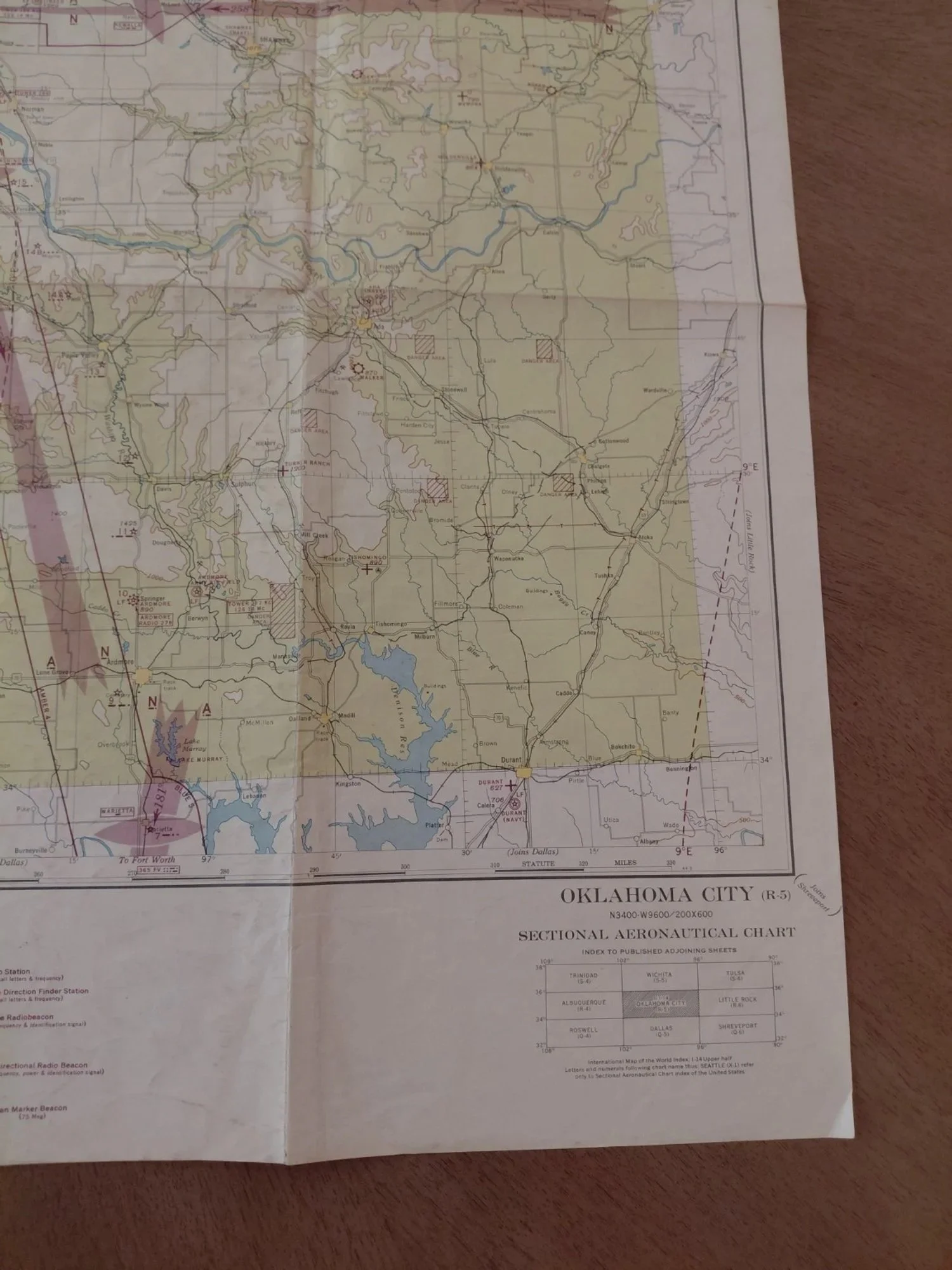
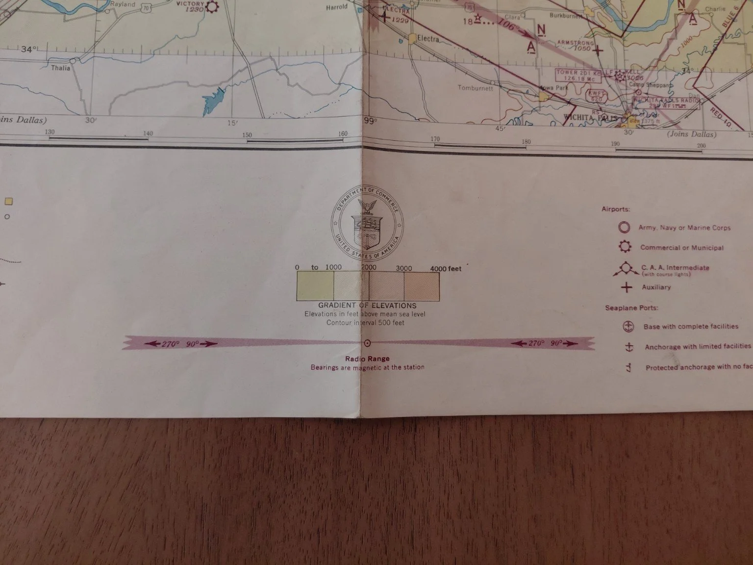
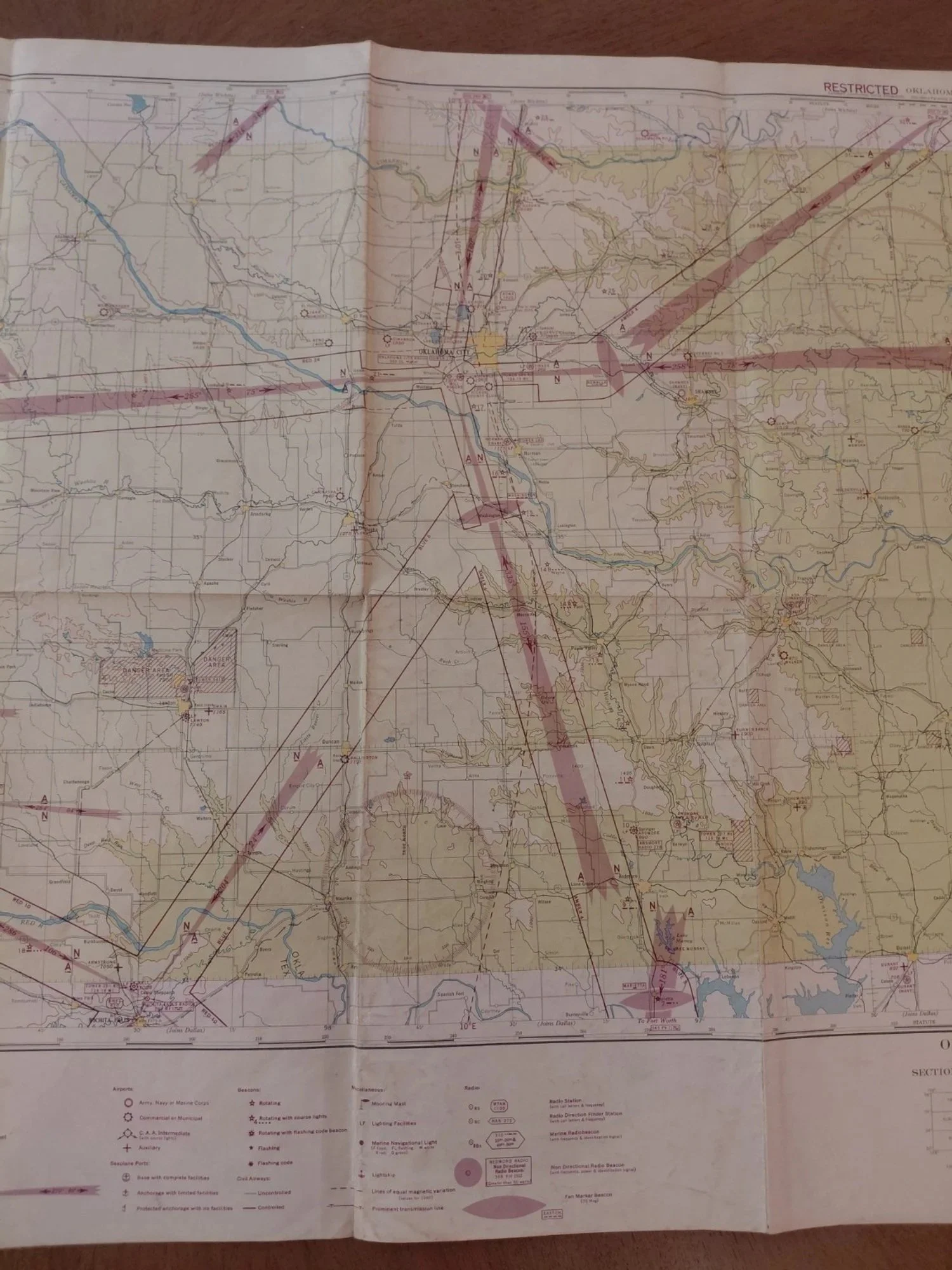
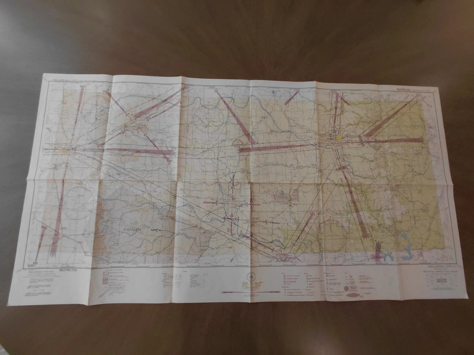
Original World War II U.S. Sectional Aeronautical Chart for Oklahoma City (R-5), issued April 6, 1944 by the U.S. Coast & Geodetic Survey under the authority of the Secretary of Commerce.
Printed with the classification “RESTRICTED”, these charts were used in WWII for both Army Air Force flight training and limited civilian aviation. This issue covers the Oklahoma City region, highlighting Army, Navy, and auxiliary airfields, radio ranges, and marked danger areas critical to wartime navigation.
Scale: Sectional Aeronautical Chart (1:500,000 approx.)
Issue Date: April 6, 1944
Publisher: U.S. Coast & Geodetic Survey, Washington D.C.
Original Price: 25 cents (printed on map)
Classification: RESTRICTED – WWII issue
Very good to excellent: Clean and bright with minimal age toning
Original fold lines (as issued for cockpit use)
No writing, stains, or tears
Exceptionally well-preserved for an 80-year-old aviation chart
Oklahoma played a pivotal role in WWII pilot training, housing multiple Army Air Force training bases, gunnery schools, and ferrying commands. Charts like this were essential tools for navigation and flight planning during the war. Surviving examples in this condition are increasingly scarce.