
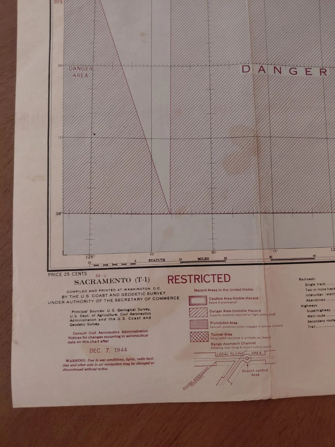
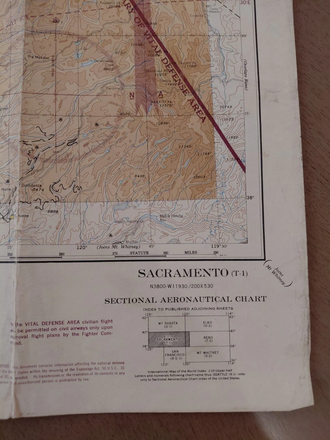
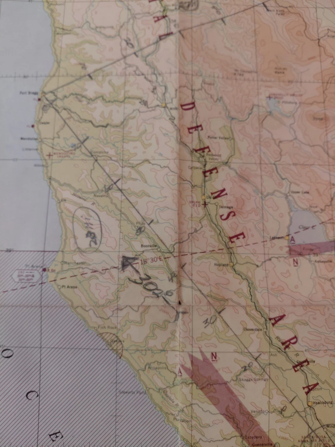
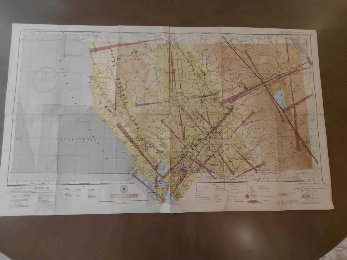
This is an original World War II U.S. sectional aeronautical chart (Sacramento T-1), issued December 7, 1944 by the U.S. Coast and Geodetic Survey. Marked “RESTRICTED”, it reflects wartime navigation conditions over Northern California, including Vital Defense Areas, Prohibited Zones, and Danger Areas.
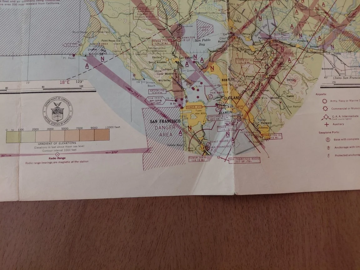
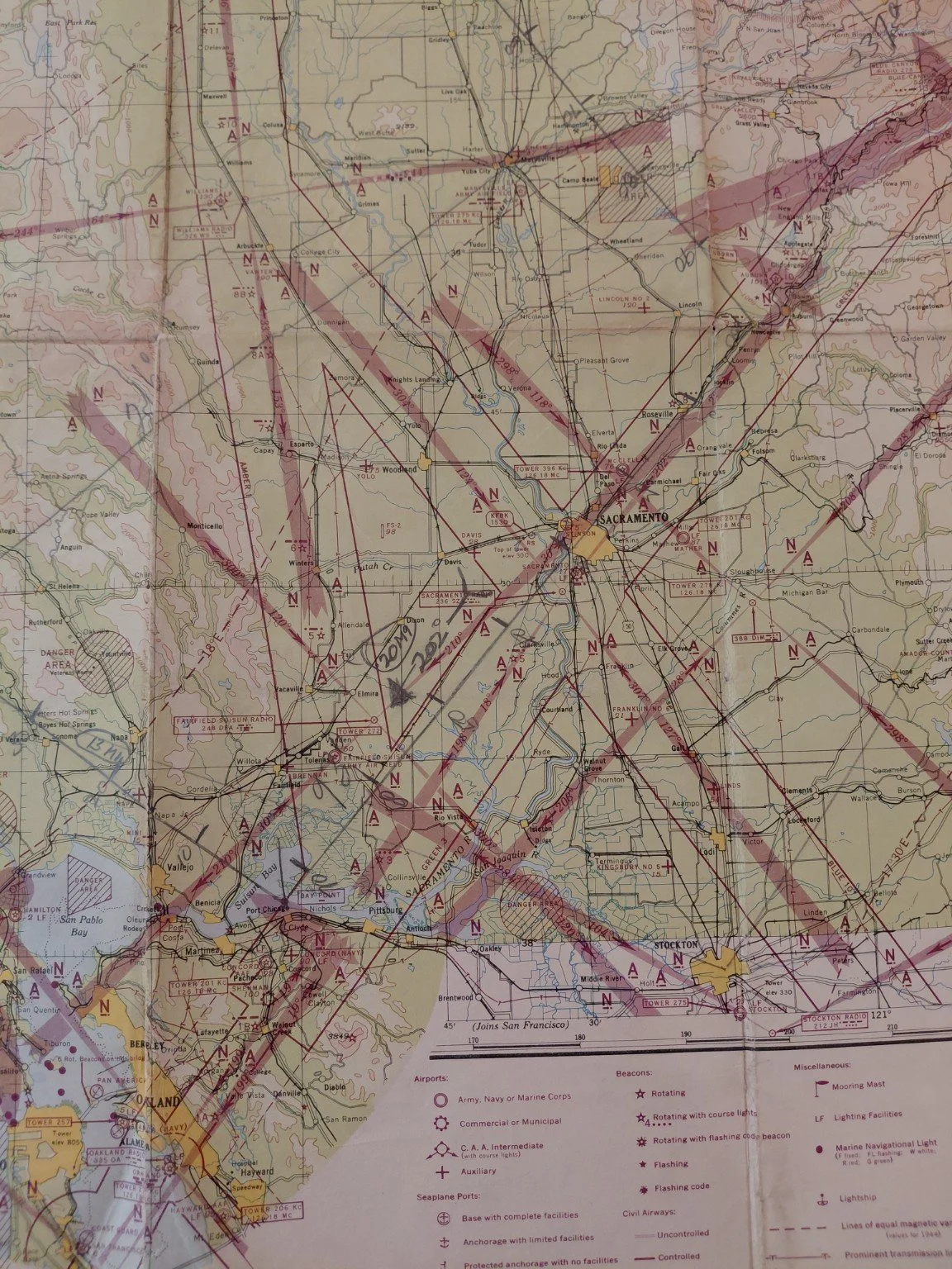
Covers the San Francisco Bay Area, Sacramento Valley, Mendocino coast, and Sierra Nevada. These charts were essential for both military and civilian pilots during WWII, when controlled airspace and national defense measures shaped American aviation.
Printed under authority of the Secretary of Commerce
Scale: 1:500,000 (200k ft elevation reference)
Original issue price: 25¢ (printed lower margin)
Condition: Folded as issued, light handling wear, minor pencil/ink plotting, excellent color retention
A rare and historic aviation chart documenting California’s skies at the height of WWII.
This is an original World War II U.S. sectional aeronautical chart (Sacramento T-1), issued December 7, 1944 by the U.S. Coast and Geodetic Survey. Marked “RESTRICTED”, it reflects wartime navigation conditions over Northern California, including Vital Defense Areas, Prohibited Zones, and Danger Areas.
Covers the San Francisco Bay Area, Sacramento Valley, Mendocino coast, and Sierra Nevada. These charts were essential for both military and civilian pilots during WWII, when controlled airspace and national defense measures shaped American aviation.
Printed under authority of the Secretary of Commerce
Scale: 1:500,000 (200k ft elevation reference)
Original issue price: 25¢ (printed lower margin)
Condition: Folded as issued, light handling wear, minor pencil/ink plotting, excellent color retention
A rare and historic aviation chart documenting California’s skies at the height of WWII.