
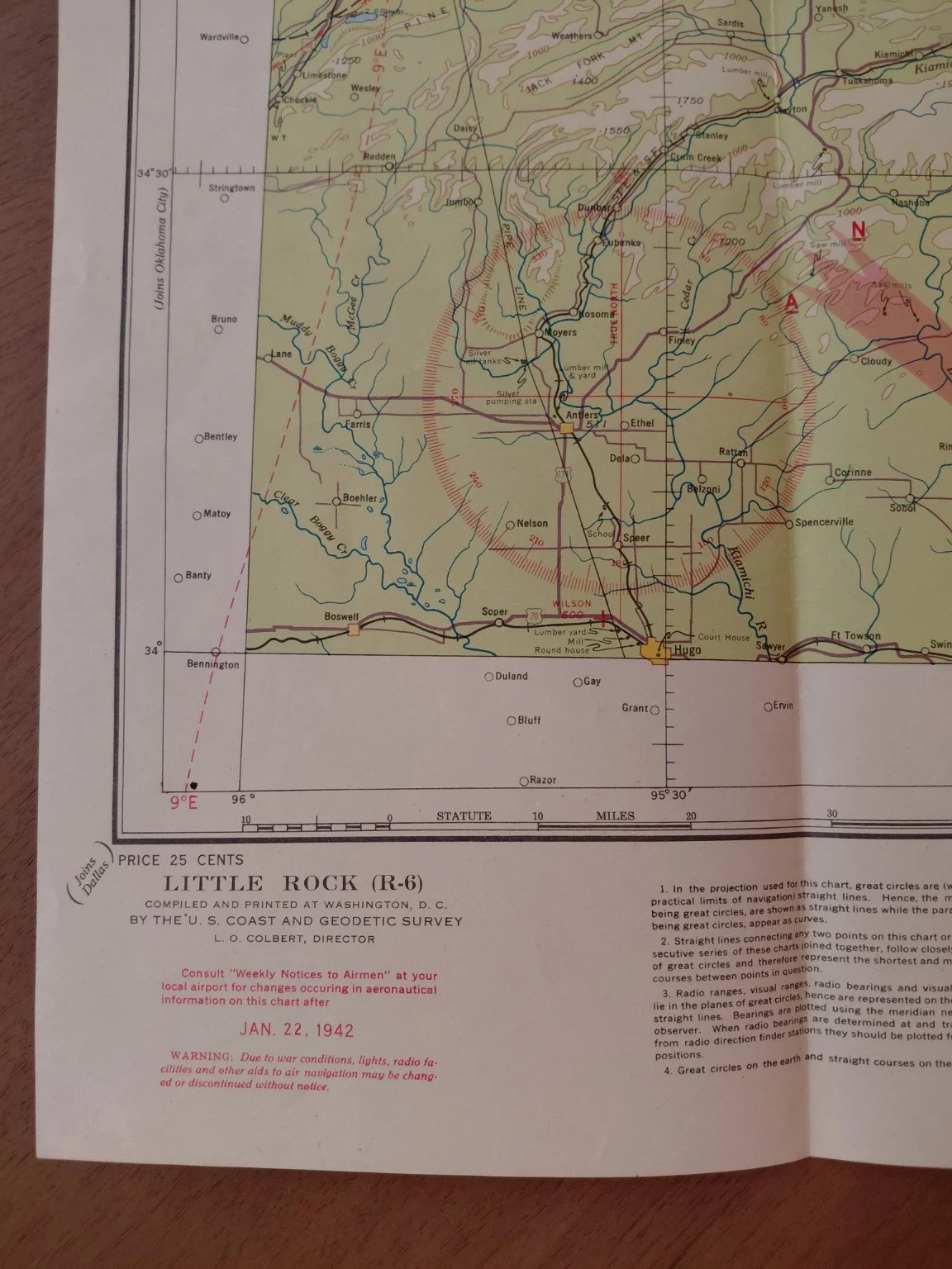
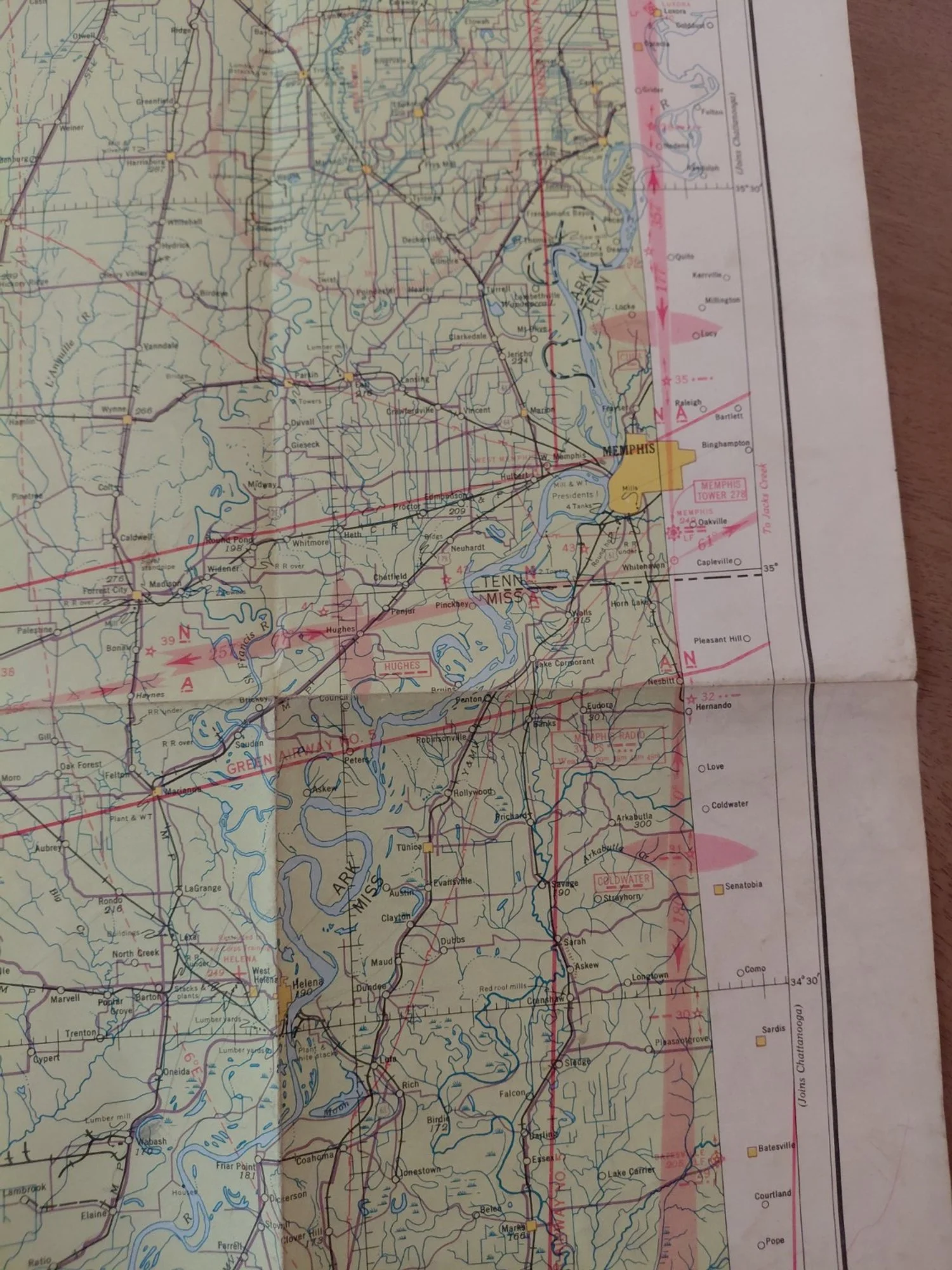
Original U.S. Sectional Aeronautical Chart covering Little Rock, Arkansas (R-6), compiled and printed by the U.S. Coast & Geodetic Survey under authority of the Secretary of Commerce.
Date of Issue: January 22, 1942
Price Printed: 25 cents
Director: L. O. Colbert
Classification: Wartime navigation chart with printed warning: “Due to war conditions, lights, radio facilities and other aids to air navigation may be changed or discontinued without notice.”
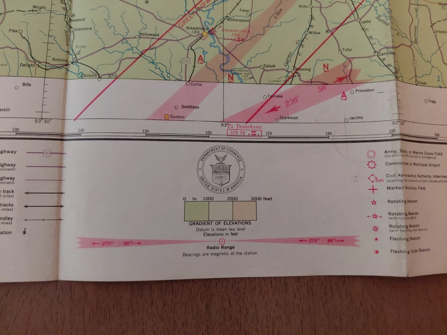
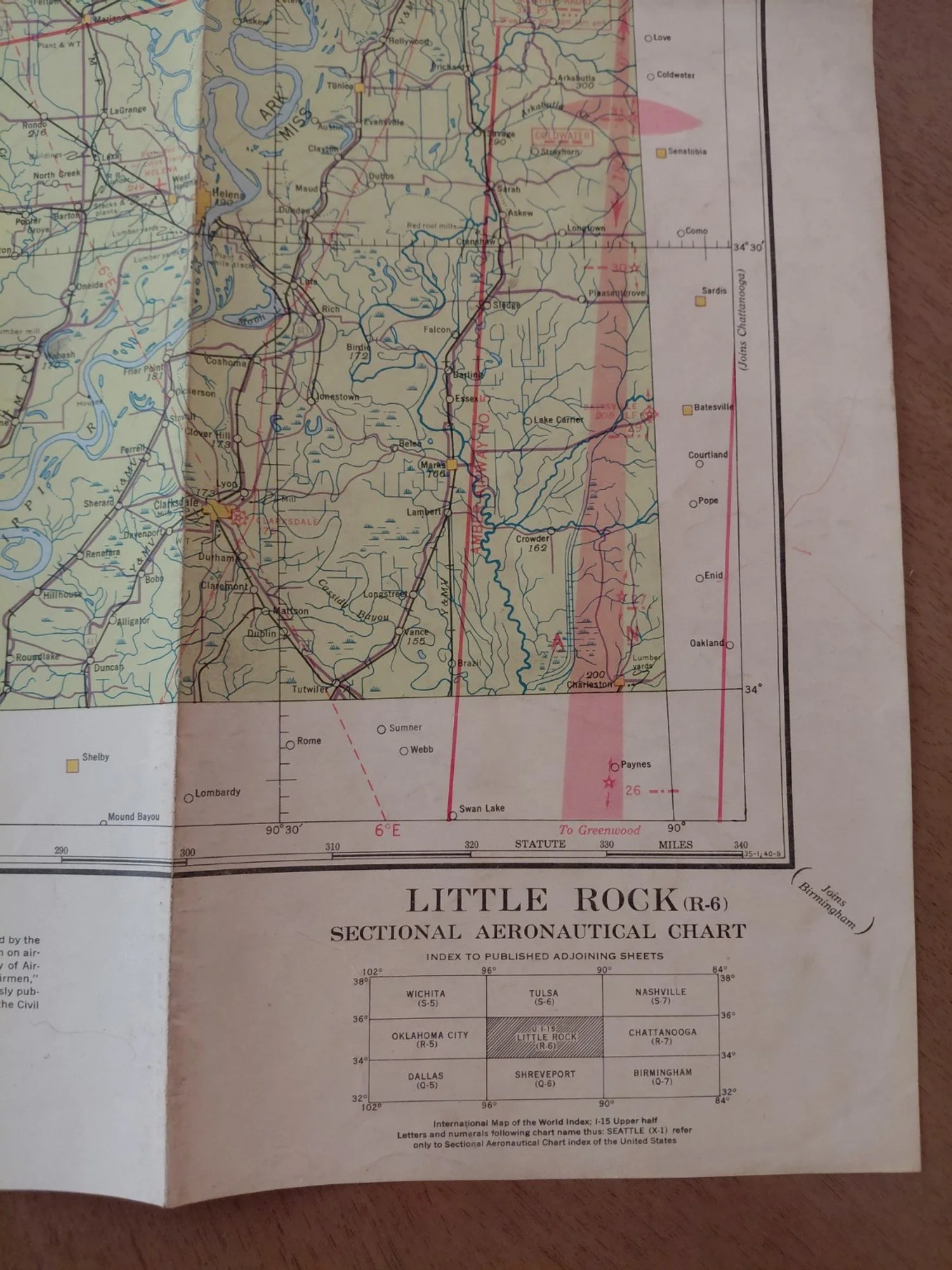
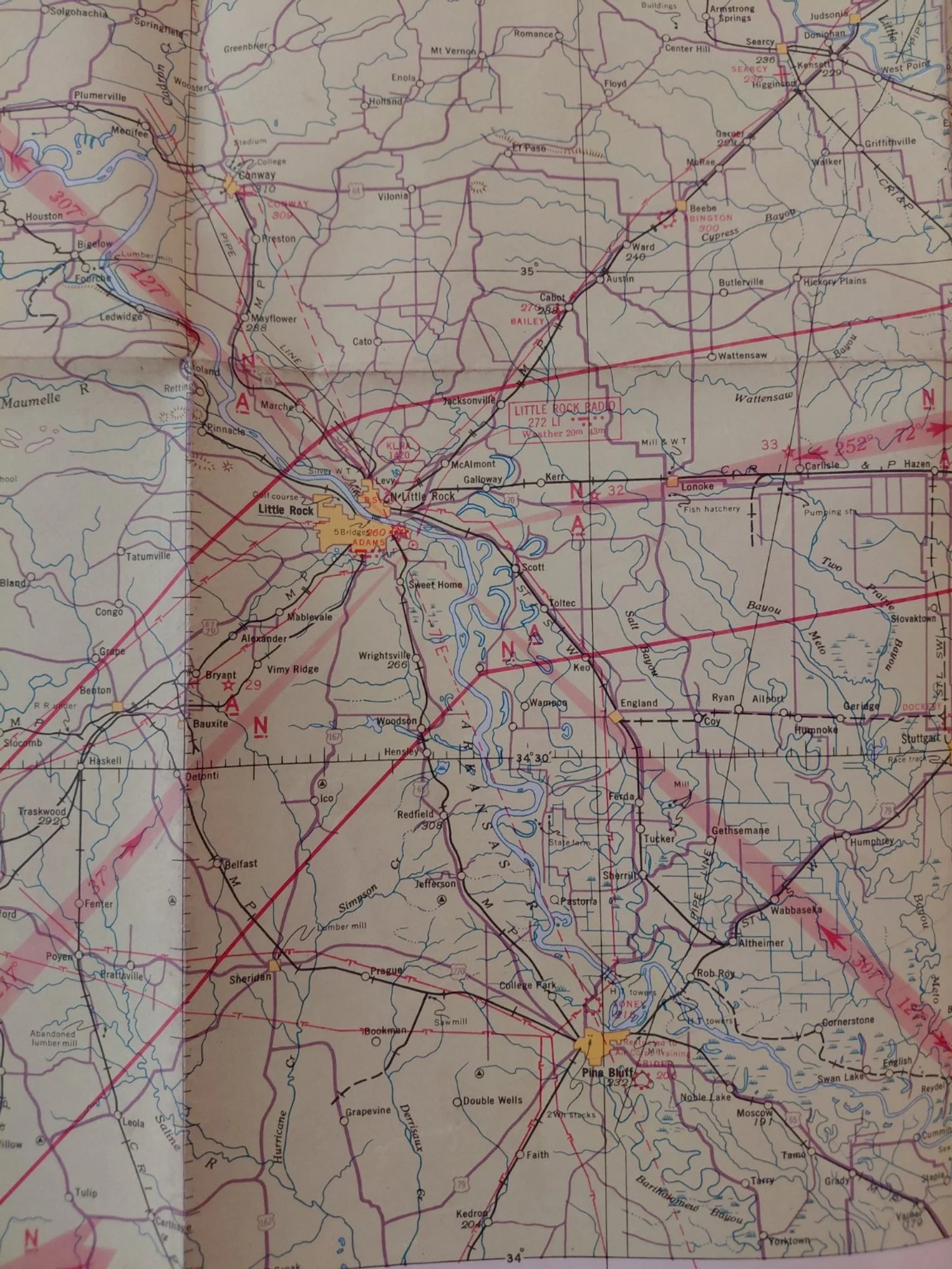
Features: Civil Aeronautics Authority intermediate and auxiliary fields, radio ranges, flashing beacons, military airfields, and full topographic detail of Arkansas and adjoining states.
Condition: Very Good to Excellent — clean, with vivid color, fold marks as issued, no major tears or losses.
Issued barely six weeks after Pearl Harbor, this is one of the earliest WWII-era navigation charts produced for both civilian and military aviators. Early 1942 examples are significantly scarcer than mid-war issues.
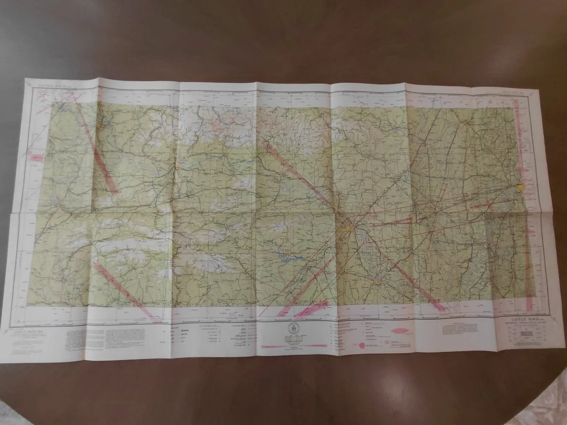
Original U.S. Sectional Aeronautical Chart covering Little Rock, Arkansas (R-6), compiled and printed by the U.S. Coast & Geodetic Survey under authority of the Secretary of Commerce.
Date of Issue: January 22, 1942
Price Printed: 25 cents
Director: L. O. Colbert
Classification: Wartime navigation chart with printed warning: “Due to war conditions, lights, radio facilities and other aids to air navigation may be changed or discontinued without notice.”
Features: Civil Aeronautics Authority intermediate and auxiliary fields, radio ranges, flashing beacons, military airfields, and full topographic detail of Arkansas and adjoining states.
Condition: Very Good to Excellent — clean, with vivid color, fold marks as issued, no major tears or losses.
Issued barely six weeks after Pearl Harbor, this is one of the earliest WWII-era navigation charts produced for both civilian and military aviators. Early 1942 examples are significantly scarcer than mid-war issues.