
1943 Dallas Sectional Aeronautical Chart (Q-5 Restricted) – WWII Aviation Map
Identification
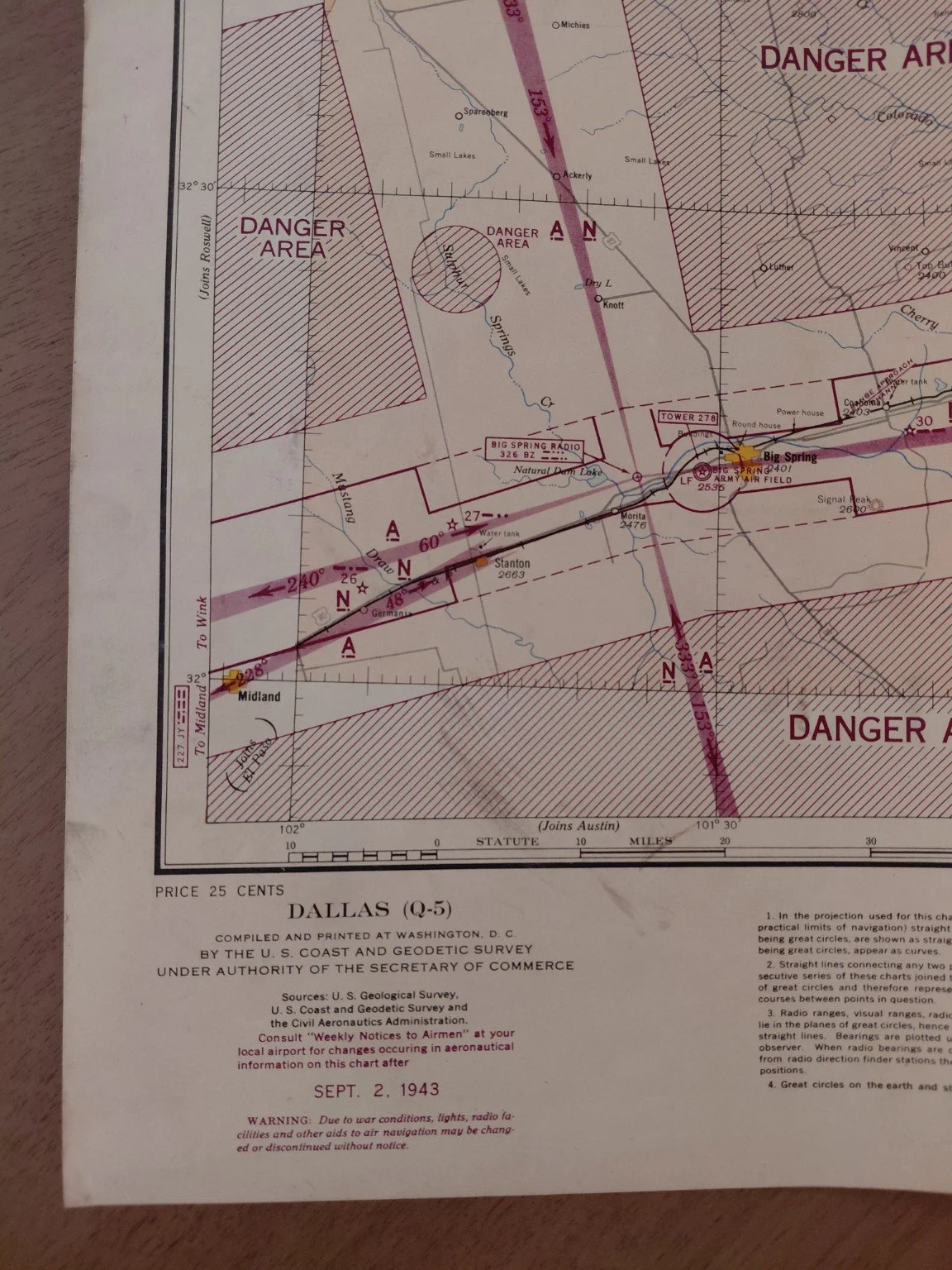
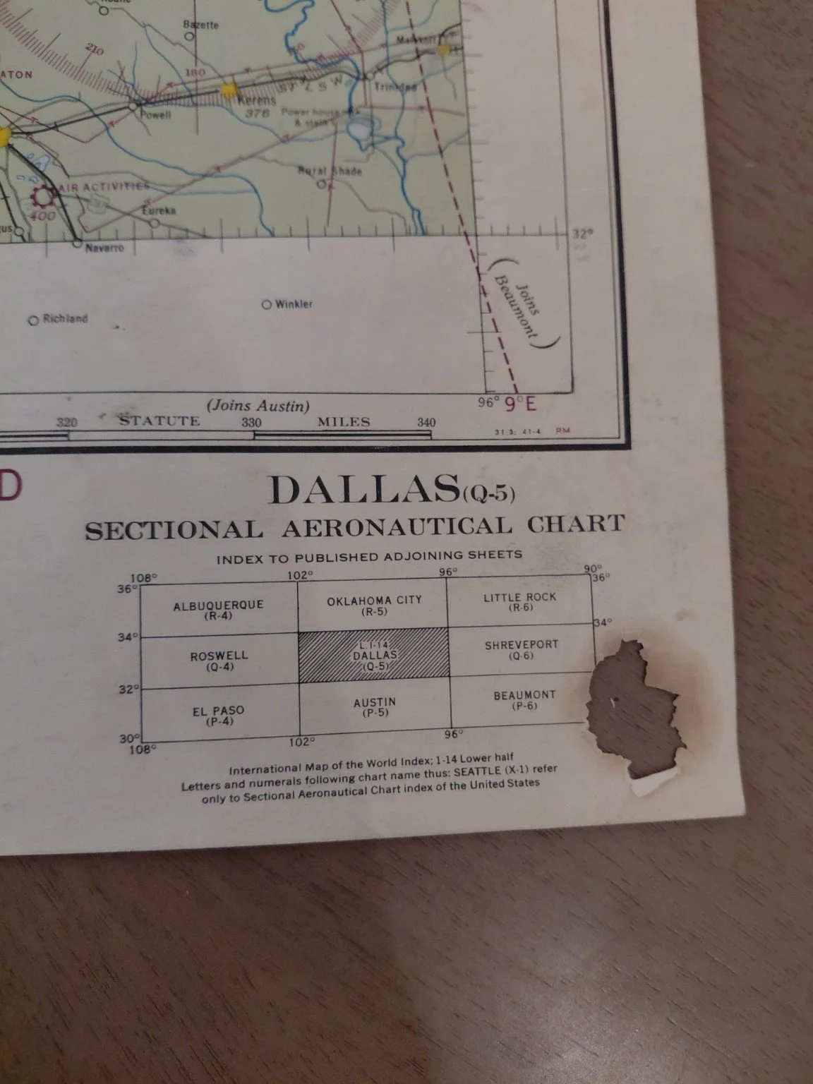
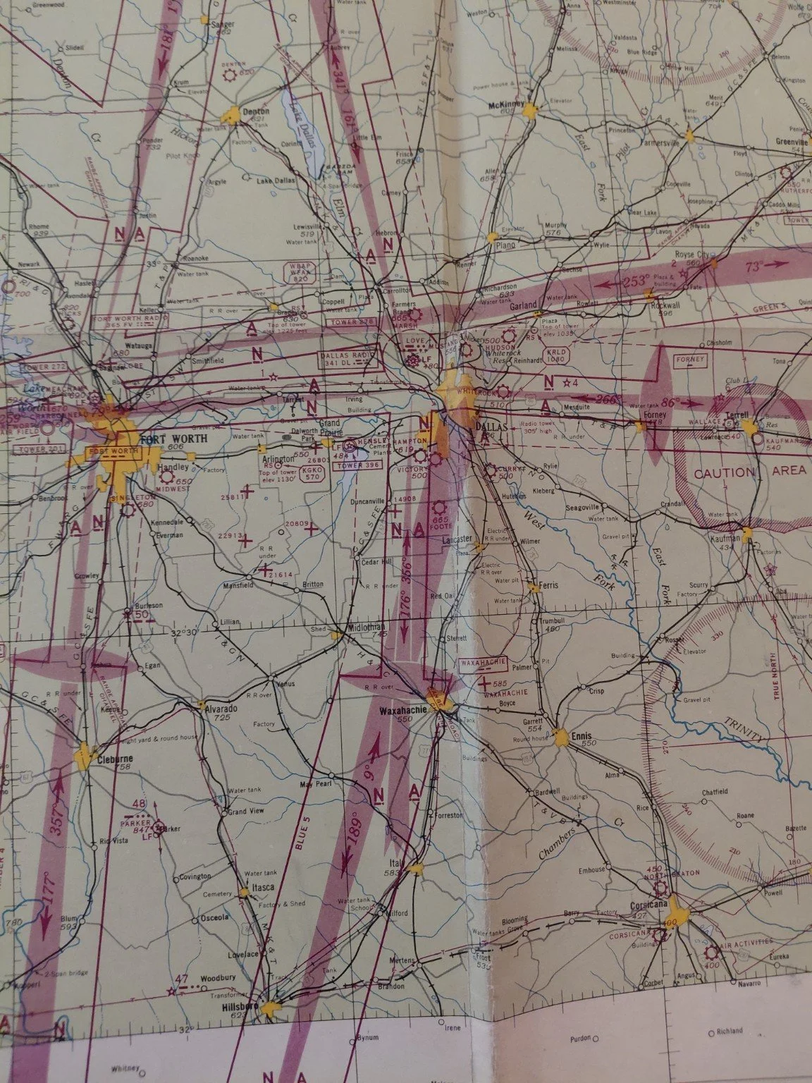
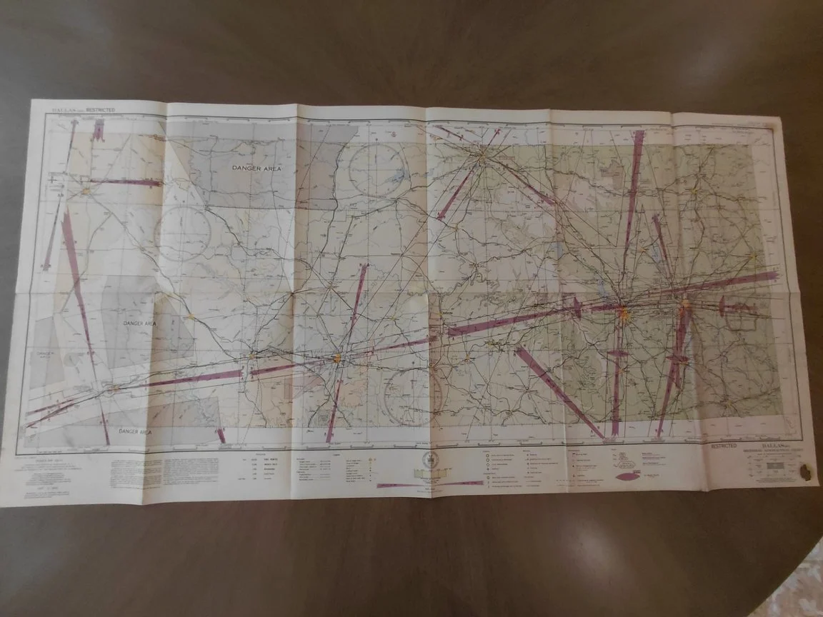
Map Title: Sectional Aeronautical Chart – Dallas (Q-5)
Date of Issue: September 2, 1943
Publisher: U.S. Coast and Geodetic Survey, under authority of the Secretary of Commerce
Principal Sources: U.S. Geological Survey, Civil Aeronautics Administration, U.S. Coast and Geodetic Survey
Region Covered: North Texas, including Dallas, Fort Worth, Corsicana, Waco, Lubbock, Big Spring, and surrounding areas.
Classification:RESTRICTED – issued during WWII under the Espionage Act and related defense regulations.
Original Printed Price: 25¢ (lower left corner)
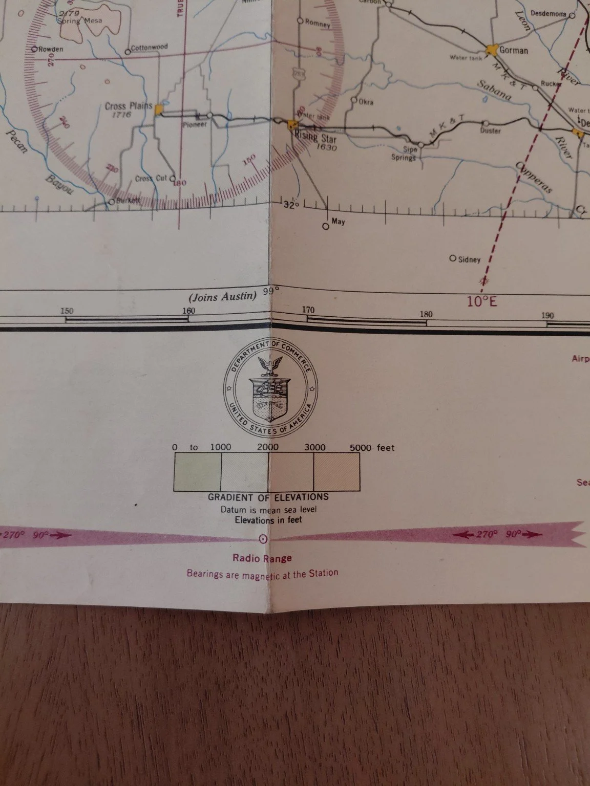
Scale: 1:500,000 (approx. 8 statute miles per inch)
This is a genuine World War II-era aviation navigation chart, intended for use by military and approved civilian pilots flying across Texas during wartime.
Historical Context
During WWII, Texas became a major aviation hub with a vast network of Army Air Fields, training schools, and industrial support. This chart predates the widespread introduction of modern VOR navigation and instead shows radio ranges, airway beacons, and restricted flight corridors that defined wartime aviation.
Restricted Classification: Civilian distribution was limited due to national security. Unauthorized possession or reproduction was prohibited.
Marked Features:
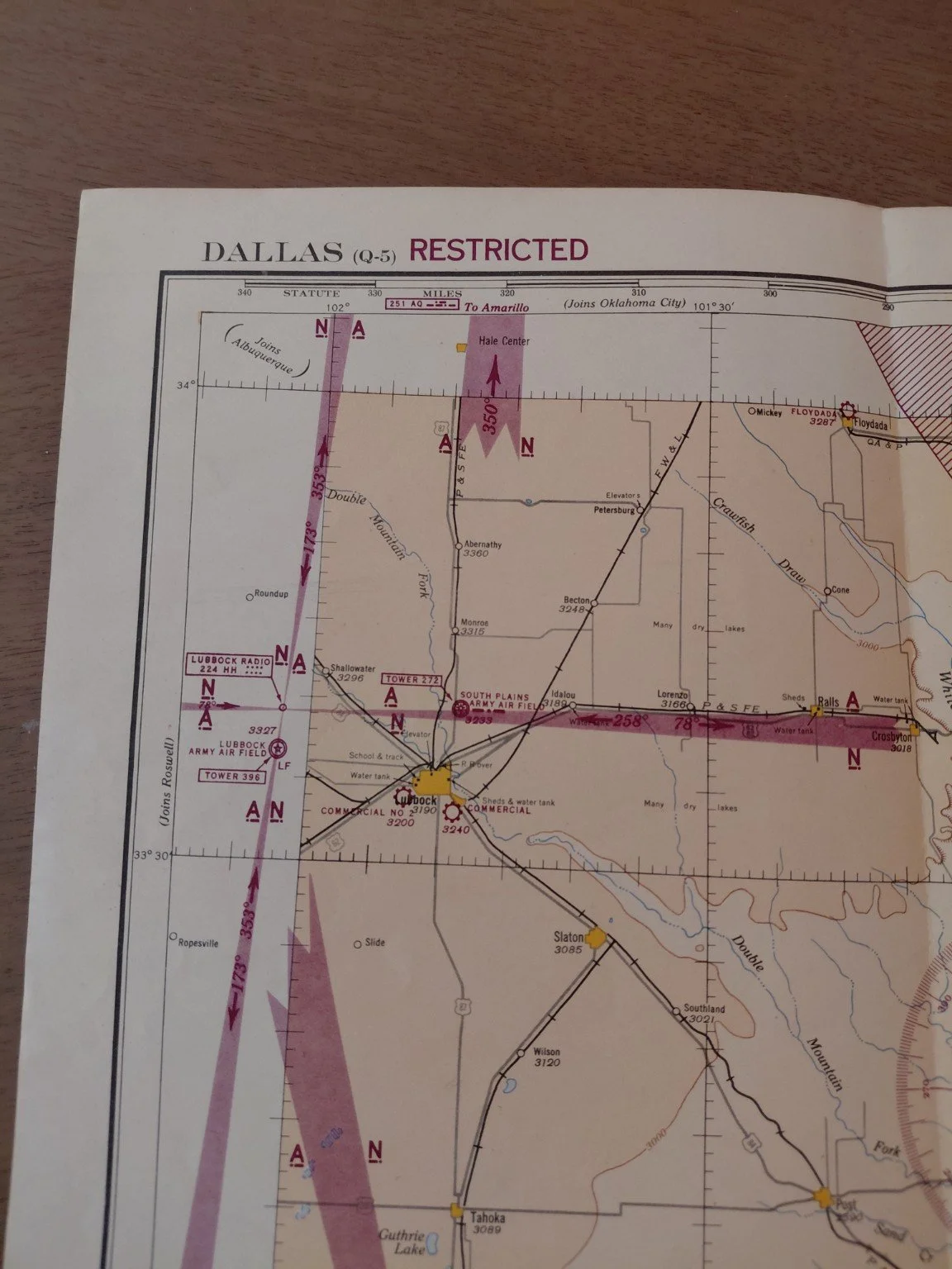
Danger Areas (shaded and cross-hatched) where live-fire training, gunnery ranges, or military operations made flying hazardous.
Radio Range Stations (shown with compass roses) that formed the backbone of wartime aerial navigation.
Army and Navy Airfields: Including Love Field (Dallas), Fort Worth Army Airfield, Lubbock Army Airfield, and South Plains Army Air Field, all key sites for pilot training and bomber transition.
Civil Aviation Routes were shown but subject to approval by Fighter Command.
This map is a frozen moment in 1943 aviation history, showing both the strategic importance of Texas and the wartime restrictions placed on its skies.
Condition
Overall: Very good for age – retains strong color and legibility.
Folds: Standard issued folds with light handling wear.
Burn Damage: One cigarette burn / hole in the lower right margin, near the adjoining sheet index. Importantly, this does not intrude into the main aeronautical content of the chart, leaving the central navigational details intact.
Other Wear: Minor edge toning, small handling marks consistent with age.
Identification
Map Title: Sectional Aeronautical Chart – Dallas (Q-5)
Date of Issue: September 2, 1943
Publisher: U.S. Coast and Geodetic Survey, under authority of the Secretary of Commerce
Principal Sources: U.S. Geological Survey, Civil Aeronautics Administration, U.S. Coast and Geodetic Survey
Region Covered: North Texas, including Dallas, Fort Worth, Corsicana, Waco, Lubbock, Big Spring, and surrounding areas.
Classification:RESTRICTED – issued during WWII under the Espionage Act and related defense regulations.
Original Printed Price: 25¢ (lower left corner)
Scale: 1:500,000 (approx. 8 statute miles per inch)
This is a genuine World War II-era aviation navigation chart, intended for use by military and approved civilian pilots flying across Texas during wartime.
Historical Context
During WWII, Texas became a major aviation hub with a vast network of Army Air Fields, training schools, and industrial support. This chart predates the widespread introduction of modern VOR navigation and instead shows radio ranges, airway beacons, and restricted flight corridors that defined wartime aviation.
Restricted Classification: Civilian distribution was limited due to national security. Unauthorized possession or reproduction was prohibited.
Marked Features:
Danger Areas (shaded and cross-hatched) where live-fire training, gunnery ranges, or military operations made flying hazardous.
Radio Range Stations (shown with compass roses) that formed the backbone of wartime aerial navigation.
Army and Navy Airfields: Including Love Field (Dallas), Fort Worth Army Airfield, Lubbock Army Airfield, and South Plains Army Air Field, all key sites for pilot training and bomber transition.
Civil Aviation Routes were shown but subject to approval by Fighter Command.
This map is a frozen moment in 1943 aviation history, showing both the strategic importance of Texas and the wartime restrictions placed on its skies.
Condition
Overall: Very good for age – retains strong color and legibility.
Folds: Standard issued folds with light handling wear.
Burn Damage: One cigarette burn / hole in the lower right margin, near the adjoining sheet index. Importantly, this does not intrude into the main aeronautical content of the chart, leaving the central navigational details intact.
Other Wear: Minor edge toning, small handling marks consistent with age.